Beta Edition
Thursday, 11 Jun 2026
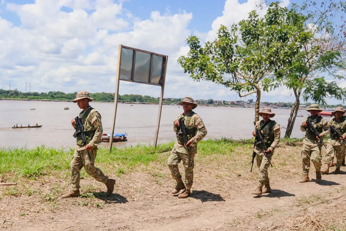
Peru and Colombia have moved troops to their remote border with Brazil over a dispute about a small island in the Amazon River.
The island, Santa Rosa de Yavarí, lies at the exact spot where the three countries meet. Both governments say it belongs to them, and both see control over it as vital for their interests.
The latest flare-up began in June 2025 when Peru’s Congress passed a law making Santa Rosa its own district in the Loreto region.
Lima says the move simply formalizes decades of Peruvian administration and improves local governance for the roughly 3,000 residents who see themselves as Peruvian.
The Peruvian government cites early 20th‑century treaties—signed with Colombia in 1922 and 1934—as proof the territory is theirs.
Colombia disputes this. Officials in Bogotá argue that those treaties defined the border along the “deepest channel” of the Amazon River in that area.
They claim Santa Rosa did not exist when the agreements were signed—it formed in the 1970s due to sediment build‑up and erosion.
Under Colombia’s interpretation, new land in the river should only be assigned after joint review.
Peru and Colombia Move Troops to Amazon Border in Island Dispute
They warn that if Peru’s claim stands, Colombia’s Amazon port, Leticia, risks losing direct river access to the Atlantic—a critical trade and transport route.
Military movements have followed the political escalation. Colombian President Gustavo Petro visited Leticia with ministers and military cadets to underline Colombia’s position.
Peru has flown its flag over the island and reinforced its presence. Both sides say they want a peaceful solution but neither shows signs of stepping back.
Behind the legal arguments lies a strategic reality. Whoever controls the island influences river traffic in the triple‑border zone.
The Amazon is the economic lifeline of the region: it moves goods, fuels local economies, and serves as the main transport route in an area with almost no roads.
It is also a corridor for illicit trade, making control a matter of security as well as commerce. Geography is complicating diplomacy.
The Amazon River constantly shifts course, and islands appear or vanish over decades.
Treaties signed a century ago could not fully anticipate these changes, yet they still define borders today. That gap between old maps and present‑day reality fuels the dispute.
For Peru and Colombia, this fight is about more than a small patch of land. It is about safeguarding trade routes, protecting sovereignty, and avoiding the perception of weakness at home.